Decide whether to buy, option, redesign or walk — on evidence, traced to source.
Before you spend a lot on a site, spend a little to understand it properly. Site Intelligence turns planning policy, technical constraints and indicative viability into one source-traced decision pack for developers, landowners and investors.
 Example session
2 of 53 designations found at or beside this plot, each with its source and collection date.
Four ways a site decision goes.
These are the four moves a site decision comes down to, not our four products. Each of our products gives you the evidence to choose your next move.
The wrong site does not fail cheaply. Most reveal their expensive problems after the architects and specialists are instructed, so we bring the evidence forward while the scheme is still cheap to change.
Proceed knowing what the site triggers, what it costs, and what to instruct first.
Secure the site while the planning route is tested and proven.
Change the scheme while change is still cheap.
Decline early, before the consultant budget is spent.
One site, read layer by layer
Choose a layer to see what it tells you about the land. These are the maps from a real demonstration pack for land at Chilham, Kent.
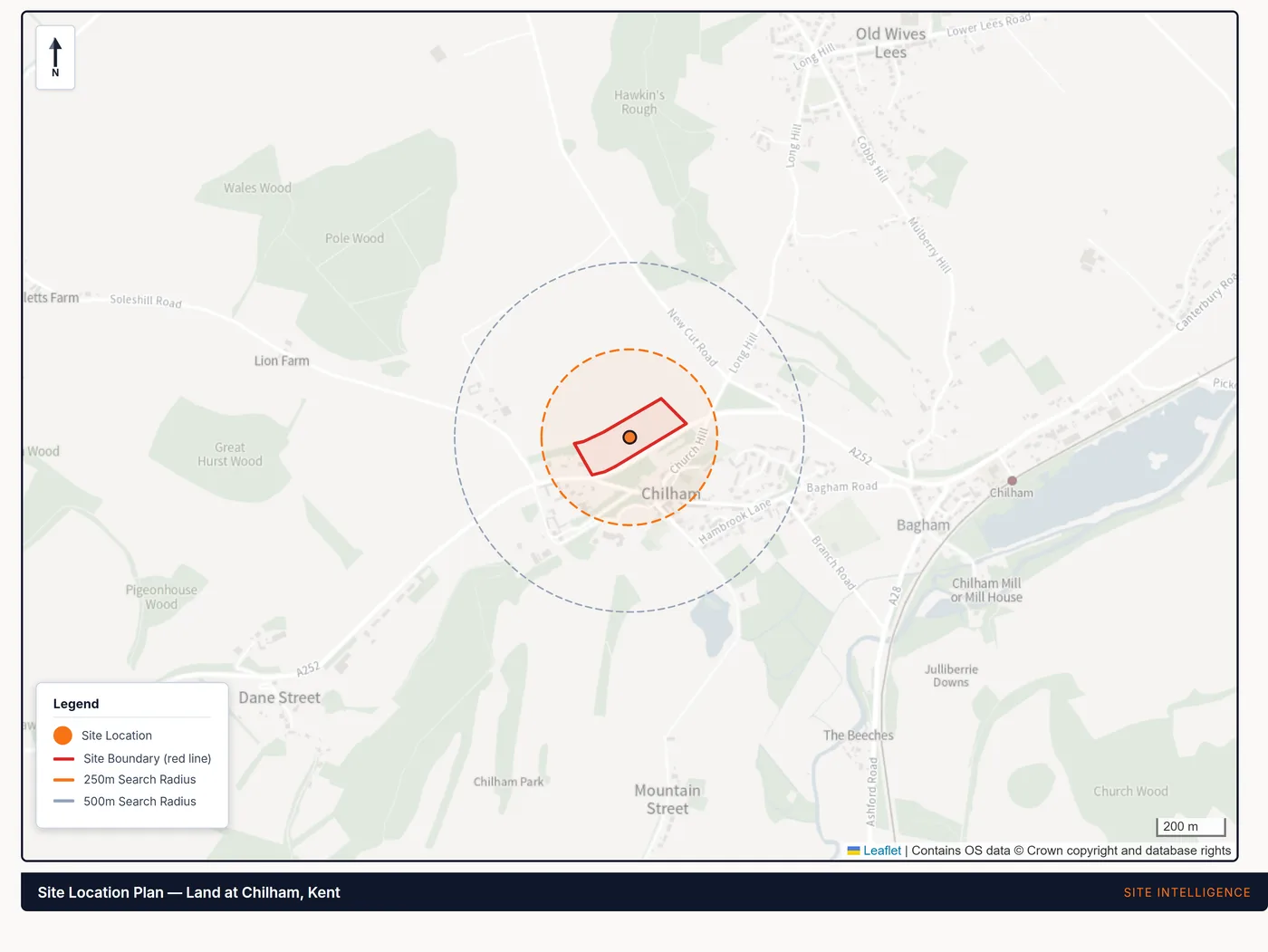
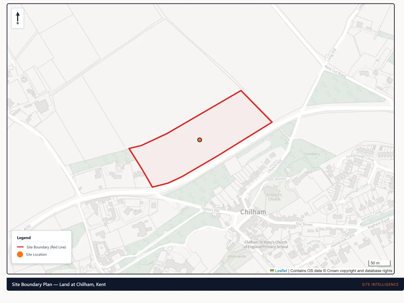
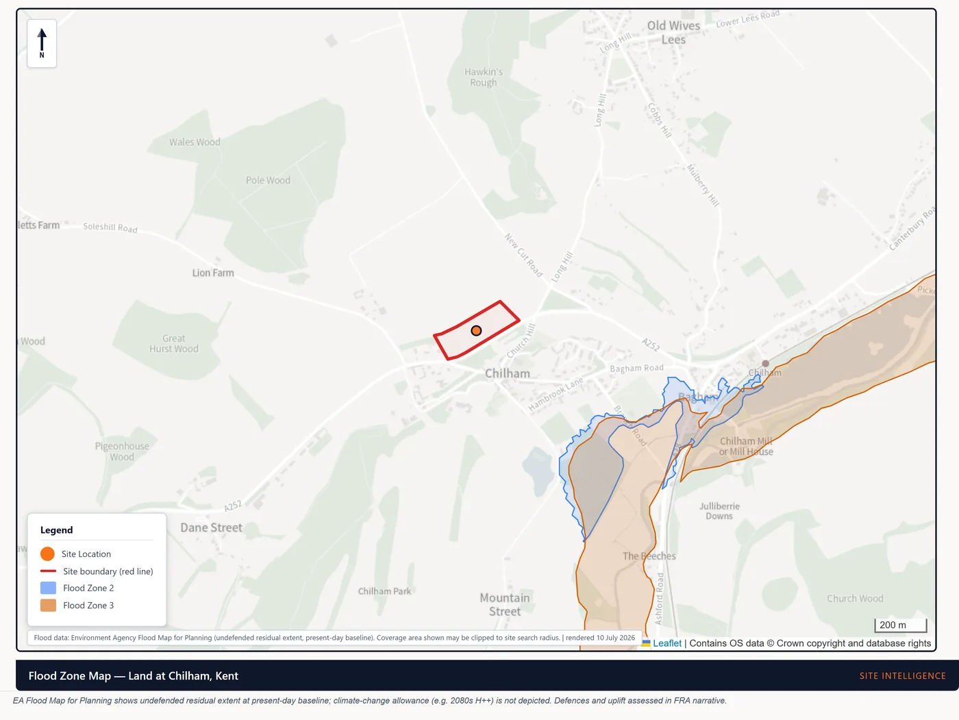
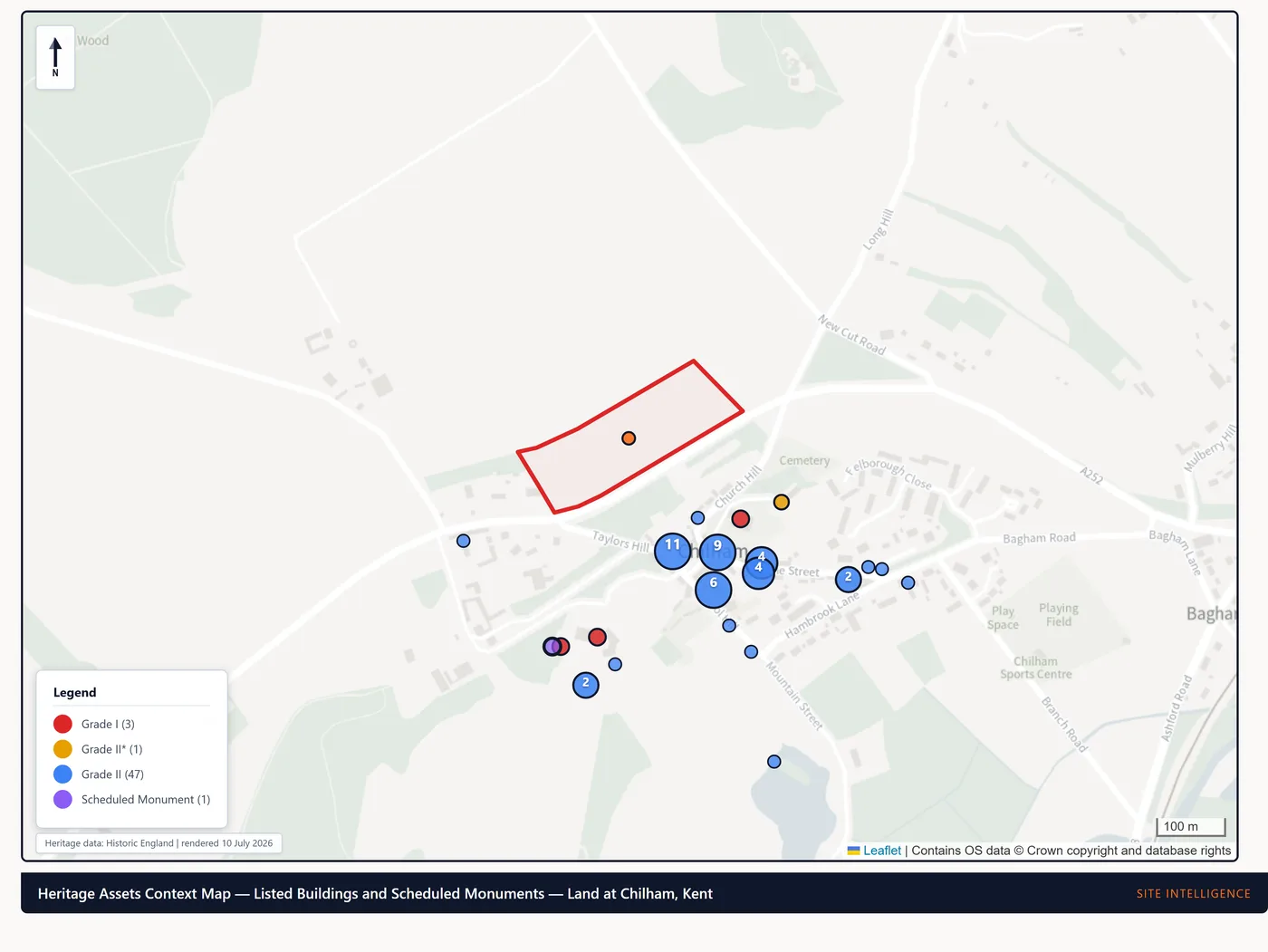
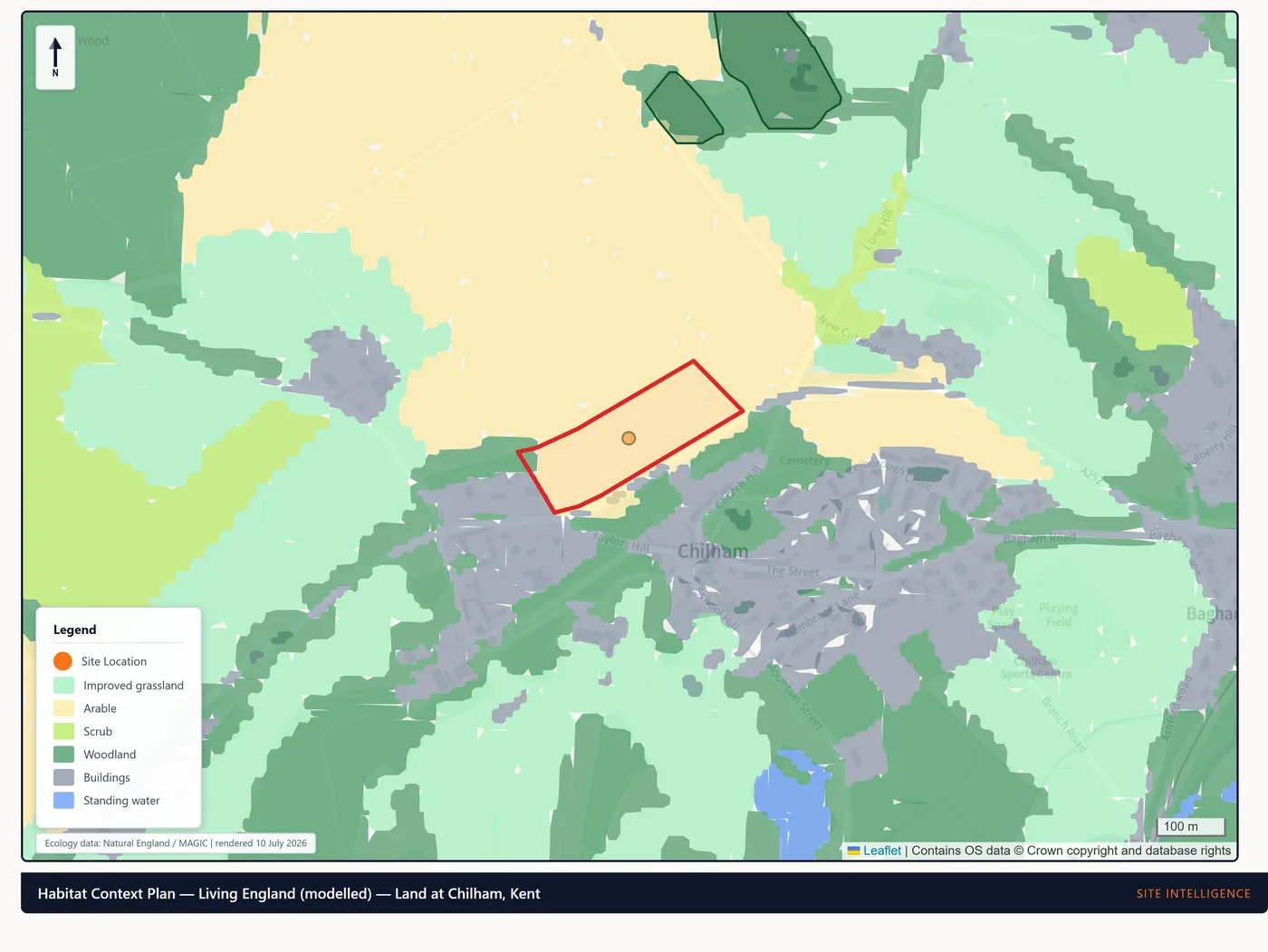
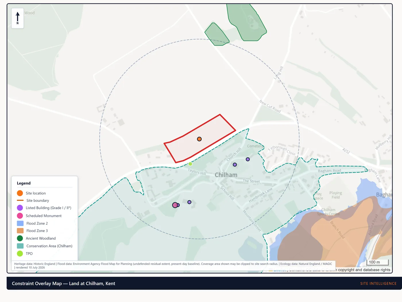
Maps rendered 10 July 2026 from Ordnance Survey, HM Land Registry, Environment Agency, Historic England and Natural England data, credited on each map.
Your council, in numbers
How the council has delivered housing, and how long it takes to decide applications, from the figures the free check and the council pages already carry.
2,645 homes delivered against a requirement of 3,345 over the three years measured. It fell short of its housing requirement, so it must hold extra housing land in reserve.
MHCLG, published 17 August 2026.
- Major schemes41.7 weeks, median of 54
- All other applications8 weeks, median of 140
Weeks from validation to decision, from the council’s own register, decided 1 July 2024 to 13 July 2026.
26 councils, including Bath and North East Somerset and Birmingham, also have a written local guide: planning in your area.
Which product is right for you?
Tell us where you are in the decision. We match you to the product, priced by your scheme size.
Site Appraisal
"Is this site worth looking at?"
A go / no-go read: a traffic-light constraint summary, a fatal-flaw check, and the list of reports you would need if you proceed.
How it works
Three steps from site address to a source-traced desktop intelligence pack.
Tell us your site
Share the address, the development type, and the scale. That's all we need.
We detect constraints automatically
We cross-reference authoritative public datasets and run automated quality checks to map the constraints that apply and the specialist input your site is likely to need.
Receive your tailored report pack
Your desktop report pack arrives on the delivery date confirmed before you pay — every figure traced to source, every constraint mapped, and a clear steer on which specialists to instruct next.
See what lands on your desk: browse the sample reports, or every product and price.
Who stands behind the work
Four defined levels of review, from automated checks to independent chartered review. No vague sign-offs.
System quality assurance
Automated checks run on every report before issue, testing data handling, internal consistency, formatting, citations, and potential accuracy and compliance issues.
Named technical review
A named technical reviewer checks every pack before it is issued. No report reaches a client on automation alone.
Formal signed review statement
A named reviewer reads the entire pack and issues a signed review statement with a defined scope and limitations. Being a formal signed statement, it adds time to the delivery date.
Independent chartered review
A separately instructed chartered practitioner reviews a defined discipline and scope, stated on the review certificate. Never a vague sign-off.
The named technical review checks every pack before it is issued. A signed review statement is a different thing: the reviewer reads every page and puts their name to a stated scope, which takes longer, so it is an add-on.
PF & Co stands behind every brief it issues. If a figure is challenged, its source, date and reasoning are one click away.
How old is the data behind a check?
The free check reads national datasets published through the government’s planning data platform. Each one is only as current as its last collection, so here is when each was last collected.
- national datasets the free check reads, each dated below
- 31
- national datasets the free check reads, each dated below
- delivery date, before you pay
- Confirmed
- delivery date, before you pay
- local planning authorities in England covered
- 308
- local planning authorities in England covered
| Dataset | Last collected | Age |
|---|---|---|
| Article 4 directions | 27 Sep 2026 | 4 days |
| Conservation areas | 27 Sep 2026 | 4 days |
| Protected trees | 27 Sep 2026 | 4 days |
| Tree preservation order areas | 27 Sep 2026 | 4 days |
| Listed buildings | 26 Sep 2026 | 5 days |
| Registered parks and gardens | 26 Sep 2026 | 5 days |
| Scheduled monuments | 26 Sep 2026 | 5 days |
| Brownfield land registers | 25 Sep 2026 | 6 days |
| World Heritage Sites | 25 Sep 2026 | 6 days |
| Local plans | 19 Sep 2026 | 12 days |
| Local nature reserves | 20 Aug 2026 | 42 days |
| Sites of Special Scientific Interest | 20 Aug 2026 | 42 days |
| Assets of community value | 5 Aug 2026 | 2 months |
| National nature reserves | 22 Jul 2026 | 2 months |
| Green Belt | 10 May 2026 | 5 months |
| Nutrient neutrality catchments | 7 May 2026 | 5 months |
| Air quality management areas | 15 Apr 2026 | 6 months |
| Ancient woodland | 21 Mar 2026 | 6 months |
| National Landscapes (AONB) | 15 Feb 2026 | 7 months |
| National Parks | 31 Dec 2025 | 9 months |
| Locally listed buildings | 22 Nov 2025 | 10 months |
| Heritage at risk | 30 Sep 2025 | 12 months |
| Flood storage areas | 8 Aug 2025 | 14 months |
| Heritage Coasts | 2 May 2025 | 17 months |
| Special Protection Areas | 28 Feb 2025 | 19 months |
| Registered battlefields | 12 Feb 2025 | 20 months |
| Ramsar sites | 4 Oct 2024 | 24 months |
| Special Areas of Conservation | 18 Sep 2024 | 24 months |
| Agricultural land classification | 15 Jul 2024 | 27 months |
| Nationally significant infrastructure projects | 29 Sep 2023 | 36 months |
| Flood zonesFor a dropped pin the check reads the Environment Agency’s current flood map live; this date is the national platform’s copy. | 24 Aug 2023 | 37 months |
A collection date is when the national platform last took in new data for that layer, not a promise that the underlying record is current. Dates as recorded on 27 September 2026, from planning.data.gov.uk (Open Government Licence v3.0).
Extension, loft, outbuilding or buying a plot — a plain-English planning review is coming later. Register interest and we will email you when it opens.
The latest from Insights
Ready to see what your site needs?
Check any site in England free, or tell us what you are deciding and we will say which report fits. We confirm the scope, the price and the delivery date before you pay.